Thursday, September 12, 2013

Desolation Lake


Aaaaahhhhh!  Love hiking mountains in the fall!  The temperatures are cooler, mountain air is crisp, leaves begin to change into vibrant colors of orange, red and yellow.  Love it! Love it! Love it!  This weeks hiking destination was Desolation Lake.  The trail begins at the Mill D North Fork trailhead about 9 miles up Big Cottonwood Canyon.  Desolation Lake is a good sized mountain lake set in a crater-like bowl which was formed by a glacier a very, very long time ago.  The size of the lake depends on the amount of snow we get in the winter.  More snow, bigger lake.  The distance to Desolation Lake from the trailhead is 3.7 miles with an elevation gain of 1,960 feet.  Also be prepared to share the trail with mountain bikers coming down from Guardsman Pass along the "spine".  At 1.8 miles from trailhead you will come to a junction with Dog Lake 0.6 miles to the left and Desolation Lake 1.9 miles to the right.  The trail is  fairly steep from the junction for about half a mile but then becomes a more gradual up.  The lake sets at 9,220 feet elevation.  The trail will pass through open meadows, lovely aspen groves (just beginning to change color) and beautiful evergreen pine.  I always like to take the time to walk around the mountain lakes if possible - take in the view from all directions.  Here is some of what we saw along the way!
Someone carved a palm on an aspen!
 

A few wildflowers still blooming.

A perfect puff ball!

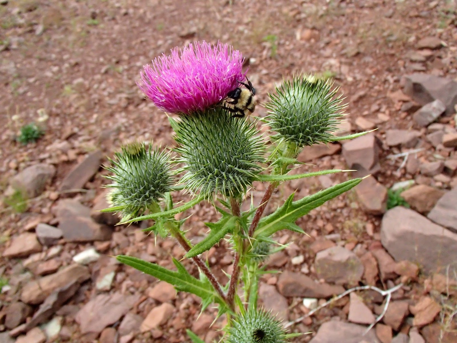
Thistle is a nuisance, but this one was pretty!
Mushrooms!
All Kinds
Arriving at Desolation Lake

Here is looking at Desolation lake from four different directions.
One last mountain view as we made our way back.  We hiked for about 8.2 miles today and got caught in the rain, but we were prepared so no big deal.

♦♦♦♦♦♦♦♦♦♦♦♦♦♦♦♦♦♦♦♦♦

Peaks Bagged

1.  Grandeur Peak ♦♦ 8299 

2.  Reynolds Peak ♦♦ 9422

3.  South Guardsman Pass Peak ♦♦ 10,420

4.  Mount Baldy ♦♦ 11,068

5.  Mount Evergreen ♦♦ 9,840

6.  Mount Tuscarora ♦♦ 10,660

7. Mount Wolverine ♦♦ 10,795

8. Sugarloaf Peak ♦♦ 11,051

******Miles hiked tally     
beginning March 22, 2013

136.2


Thursday, September 5, 2013

Sugarloaf Peak 11,051

Sugarloaf Peak with Devils Castle in background.

We only intended to hike to Germania Pass today - just an easy hike above Cecret Lake in Little Cottonwood canyon.  Germania Pass is the saddle on Bullion Divide between Little Cottonwood canyon and American Fork canyon, smack dab in the middle of Alta ski resort.  When you reach Germania Pass at 10,500 feet, Mount Baldy is only a half mile to the west (already climbed that one this year) and Sugarloaf Peak is 1/3 mile to the east.  What the hey!  We decided to climb on up to the summit of Sugarloaf Peak (11,051).  It wasn't the greatest of trails, but we made it!  Bagged another mountain peak!  This adventure began at the Cecret Lake trailhead near Albion Basin campground, passing pretty Cecret Lake and following the ski lifts to Germania Pass.


The trail was very steep across loose rocks.  Thank goodness for a few cairns to mark the way.  This is the view climbing up.

We make it to the top!  And another hiker was just waiting there to take our picture.  He was impressed that a couple of grandmas made the climb. (I was kind of impressed too!)  Beautiful mountain views in all directions.  We are standing in front of Timpanogos.
Pictured below are Timpanogos, American Fork Twin Peaks, Mount Superior/Monte Cristo and Devil's Castle.  Great views from Sugarloaf!

Geological marker - proof we were at top!
Now the seriously hard part for me was getting down!  The other hiker we met at the top of Sugarloaf climbed down the west side towards Devil's Castle.  We could see him on the trail far below when we were ready to head down so we decided to try his way.  Not good!  Again not much of a trail and very, very steep with loose rock debris covering a greater majority of the trail.
Heading down towards Devil's Castle

Looking back up at the top of Sugarloaf.
We saw the most beautiful ferns growing from the rocks near the end of our hike.


A final look back at Sugarloaf Peak.  Climbing this one was a big accomplishment!
The map explains our journey!
But doesn't show any trails going up or coming down.
 

My best calculation is that we hiked a distance of 3.5 miles with an elevation gain of about 1600 feet.  We didn't have the GPS working today and my phone app isn't trust worthy.


♦♦♦♦♦♦♦♦♦♦♦♦♦♦♦♦♦♦♦♦♦

Peaks Bagged

1.  Grandeur Peak ♦♦ 8299 

2.  Reynolds Peak ♦♦ 9422

3.  South Guardsman Pass Peak ♦♦ 10,420

4.  Mount Baldy ♦♦ 11,068

5.  Mount Evergreen ♦♦ 9,840

6.  Mount Tuscarora ♦♦ 10,660

7. Mount Wolverine ♦♦ 10,795

8. Sugarloaf Peak ♦♦ 11,051

******Miles hiked tally     
beginning March 22, 2013

128


Wednesday, September 4, 2013

Shoshone Lake @ Yellowstone NP

DeLacy Creek as it flows into Shoshone Lake
Shoshone Lake is the largest backcountry lake in Yellowstone.  There are NO roads leading to Shoshone Lake only hiking trails or canoeing up the Lewis River.  By far the easiest access to Shoshone Lake is the DeLacy Creek trail, a mere 8 miles east of Old Faithful.  DeLacy Creek is a wonderful trail through thick forest carpeted with lush, green grass.  You will also hike across open meadows and along the creek covered with lily pads.  It is 3 miles from the trailhead to the lake, but virtually no elevation gain which makes for a very pleasant walk of 6 miles roundtrip.
Lush green grass even at the end of August.
We didn't see any wildlife on our hike, but it felt like moose or elk country.

Relaxing on the shores of Shoshone Lake

Close up of the black obsidian beach

There were still a few wildflowers at the lake.
A sure fire way to escape the crowds in Yellowstone is to take a hike.  I bet 95 percent of those visiting the park never venture more than a few yards from their cars.

♦♦♦♦♦♦♦♦♦♦♦♦♦♦♦♦♦♦♦♦♦

Peaks Bagged

1.  Grandeur Peak ♦♦ 8299 

2.  Reynolds Peak ♦♦ 9422

3.  South Guardsman Pass Peak ♦♦ 10,420

4.  Mount Baldy ♦♦ 11,068

5.  Mount Evergreen ♦♦ 9,840

6.  Mount Tuscarora ♦♦ 10,660

7. Mount Wolverine ♦♦ 10,795

******Miles hiked tally     
beginning March 22, 2013

124.5


Monday, September 2, 2013

Jenny Lake @ Grand Teton NP

In the heart of Grand Teton National Park sets pretty Jenny Lake right at the base of a majestic trio of mountain peaks called Teewinot, Grand Teton and Owen.  It is a GRAND sight to behold!  Our plan was to hike around the southwest portion of Jenny Lake, check out Hidden Falls make our way up to Inspiration Point and then catch the shuttle boat back across the lake.  Sounds like a great day to me and it was!
 
The trail for hiking around Jenny Lake begins at the shuttle boat launch near the south end of the lake.  Most folks ride the shuttle boat across Jenny Lake then do the short, but somewhat steep hike up to Hidden Falls, a beautiful 80 foot water fall, then return via shuttle boat.  The roundtrip price for the boat ride is $12.  The one way price for those who hike is $7 which you will pay upon returning to boat dock.  Shuttle boats leave about every 15 minutes and in the heart of summer begin shuttling people as early as 7:00 am.  Jenny Lake is very popular during summer so my advice is to get an early start.  The trail around the lake to the falls is a pleasant hike of about 2.3 miles with an addition half mile to reach Inspiration Point.  Here is some of what we saw along the way.
Hidden Falls

Bambi checking us out!


Jenny Lake from Inspiration Point
Fuzzy wuzzy caterpillar.
I highly recommend the additional climb to Inspiration Point for fantastic mountain peak views.  The trail continues further into Cascade Canyon.  Maybe next time!


Zoomed in view of snow still on the peak.

♦♦♦♦♦♦♦♦♦♦♦♦♦♦♦♦♦♦♦♦♦

Peaks Bagged

1.  Grandeur Peak ♦♦ 8299 

2.  Reynolds Peak ♦♦ 9422

3.  South Guardsman Pass Peak ♦♦ 10,420

4.  Mount Baldy ♦♦ 11,068

5.  Mount Evergreen ♦♦ 9,840

6.  Mount Tuscarora ♦♦ 10,660

7. Mount Wolverine ♦♦ 10,795

******Miles hiked tally     
beginning March 22, 2013

118.5


Sunday, August 25, 2013

Butler Fork Trail


I wish it were possible to capture and share that sweet mountain fragrance.  Nothing beats the smell of mountain air especially in the morning!  Today I decided to hike a little ways up the Butler Fork trail.  Butler Fork trail begins 8.2 miles up Big Cottonwood Canyon where you will find a small parking area right at the trailhead.  Butler Fork will take you to Dog Lake as well as to the top of Mount Raymond and Gobblers Knob.  I was short on time today so my goal was to hike one mile up to just check out the trail.  And I really liked it!!  I will definitely be repeating this hike!  Check it out . . .

Butler Fork trail had everything you could want in a mountain trail; beautiful pines, lush vegetation, follows a small stream, plenty of aspen, wildflowers and great views.


After about half a mile you will come to a junction with a small sign for Dog Lake on the right and Mill A Basin on the left.  I choose left to Mill A Basin.
A little further up the trail I met a bow hunter coming down the trail.  I worried a little that it might not be safe to hike with hunters in the canyon.  Next time wear my bright orange!  But he was very nice and gave me some good information about the trail.
Again the wild plants were amazing.  Some of the cone flowers and elderberry plants were taller then me.  And the I love the brilliant orange berries of the mountain ash trees.

Before I turned around to head down I got a pretty good picture of Gobblers Knob.
Looking down from Mill A Gulch at the Big Cottonwood Canyon road.  Also a view of Kessler Peak.

Kessler Peak is barely visible.
I enjoyed my hike as usual.  Mother nature rarely disappoints!


♥♥♥♥♥♥♥♥♥♥♥♥♥♥♥♥♥♥♥♥♥

"For myself I hold no preferences
among flowers so long as they are
wild, free, spontaneous!" Ed Abbey 

 Wildflower of the Week


The Butler Fork trail was covered with these Showy Goldeneyes.  The Showy Goldeneye looks like a small yellow sunflower.  It was nice to see wildflowers at the end of August and you will see these by the thousands.

♦♦♦♦♦♦♦♦♦♦♦♦♦♦♦♦♦♦♦♦♦

Peaks Bagged

1.  Grandeur Peak ♦♦ 8299 

2.  Reynolds Peak ♦♦ 9422

3.  South Guardsman Pass Peak ♦♦ 10,420

4.  Mount Baldy ♦♦ 11,068

5.  Mount Evergreen ♦♦ 9,840

6.  Mount Tuscarora ♦♦ 10,660

7. Mount Wolverine ♦♦ 10,795

******Miles hiked tally     
beginning March 22, 2013

115.7