Neffs Canyon is the west facing bowl directly above Olympus Cove just south of Millcreek Canyon. Getting to the trailhead is a little tricky because you have to wind your way through the neighborhood to find the White Park trailhead. There are several sign for Neffs Canyon posted to help you find your way. For me this trail lacked a "WOW" factor and the destination, a meadow, didn't knock my socks off. The trail follows an old road for about 1.25 miles so the first part is pretty easy walking. Once you reach the Mount Olympus Wilderness sign the trail becomes steep and that steepness doesn't let up until you reach the meadow. From the White Park trailhead it is 2.75 miles to get to the meadow with an elevation gain of 2450 feet. You really work the old calf muscles on this hike!
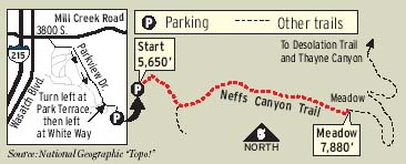
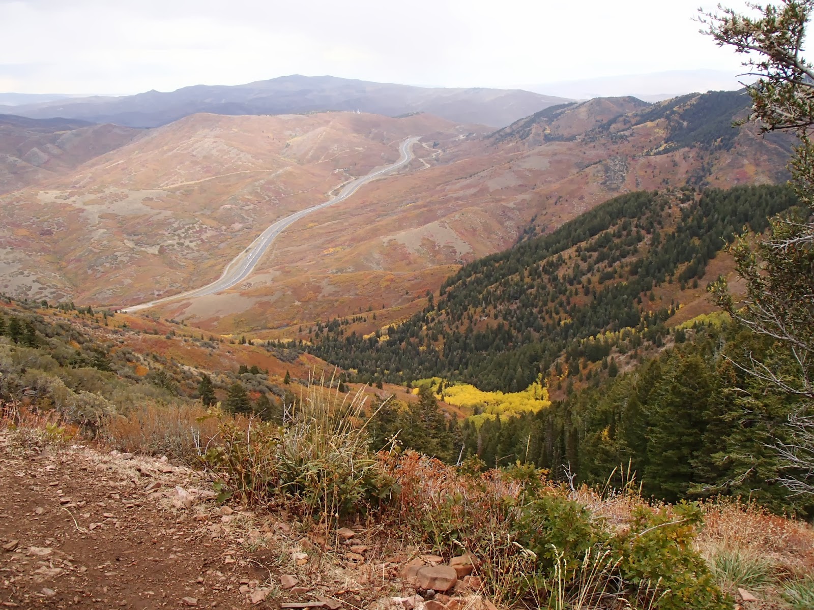
There were some pretty cool rock formations along the way and the snow frosted mountain peaks were impressive. The meadow also gives a unique perspective of Mount Olympus and it is always fun to look down on the Salt Lake Valley from way up high. Okay so it was a pretty good hike after all.


I also wanted to share the American Hiking Society's list of 10 Essentials. Ten things to have on every hike. (For more details check out www.AmericanHiking.org)


- Appropriate footwear. Can't emphasize enough how important it is to have a good pair of hiking shoes AND socks on your feet!
- Carry a GPS, compass or map.
- Extra water and a way to purify it.
- Plenty of food. You burn a lot of calories hiking!
- Rain gear or extra clothing.
- Safety items: fire (matches), light and a whistle.
- First aid kit.
- Knife or multi-purpose tool.
- Sun screen and sun glasses.
- Daypack or backpack. ♦♦♦♦♦♦♦♦♦♦♦♦♦♦♦♦♦♦♦♦♦
Peaks Bagged 2013
1. Grandeur Peak ♦♦ 8299
2. Reynolds Peak ♦♦ 9422
3. South Guardsman Pass Peak ♦♦ 10,420
4. Mount Baldy ♦♦ 11,068
5. Mount Evergreen ♦♦ 9,840
6. Mount Tuscarora ♦♦ 10,660
7. Mount Wolverine ♦♦ 10,795
8. Sugarloaf Peak ♦♦ 11,051
9. Little Water Peak ♦♦ 9,605
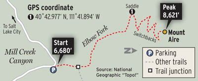
10. Mount Aire ♦♦ 8,621
******Miles hiked tallybeginning March 22, 2013
168.9