Saturday, May 10, 2014

Adams Canyon

Adams Canyon is a Davis County hiking treasure which follows an abundant stream for much of the hike and ends with a stunning 40 foot waterfall.  Be prepared to get your feet wet on this hike because you must cross the stream to even get to see the plunging waterfall.  Good news is the stream is wide and not deep.  Some type of water shoe is advisable so you don't have to hike back in wet shoes. You will not want to miss seeing this waterfall!!
Adams Canyon is a very popular hiking trail and yet very poorly marked.  Somebody must be trying to keep this place a secret.  The trailhead is located just off highway 89 and east of Oak Hills Drive in Layton, Utah.  There isn't a right turn off 89 onto Oak Hills Drive to reach the trailhead so you will need to drive about a quarter mile beyond the sign for Oak Hills Drive and take a small frontage road to backtrack towards the trail parking area.  Nothing really there to let you know you are in the right place.  How rude!!
 

The trail begins by climbing a series of very sandy switchbacks.  Please stay on the trail . . .  there is evidence of erosion problems.  This portion of the trail could be very hot on a summer afternoon.  The trail also meets up with the Bonneville Shoreline trail before heading into Adams Canyon (a favorite of mountain bikers).  At this point you begin to follow Holmes Creek for the rest of the way to the waterfall.  Total round trip distance for this hike is 3.8 miles. 


After about 1.5 miles you will cross a footbridge and the trail becomes a little steeper.  The next obstacle is a giant slab of rock that blocks the trail and you must climb up and around this giant to connect back with the trail.  No big deal.


Adams Canyon is dog friendly, but please be courteous to other hikers and keep dogs on leash and take out the poop.   Here is an enthusiastic canine hiker.
There were several other good sized waterfalls on the trail to keep you entertained.
But of course, the main event is the 40 foot waterfall at the end of the trail!
Enjoy!!


♥ ♥ ♥ ♥ ♥ ♥ ♥ ♥ ♥ ♥ ♥ ♥ ♥ ♥ ♥ ♥ ♥


 Wildflower of the Week


This wildflower is a Utah Milkvetch also known as Locoweeds.  Too pretty to be called Locoweeds.  Look closely at the flower petals, they remind me of butterfly wings. You can't miss these bright colored flowers, they are everywhere on the foothills and benches this time of year.  Milkvetch are part of the pea family.


For myself I hold no preferences among flowers
so long as they are wild, free, spontaneous!"
Ed Abbey

♥♥♥♥♥♥♥♥♥♥♥♥♥♥♥♥♥♥♥


******Miles hiked tally
beginning March 22, 2013
Beginning of this Blog


269.4


Friday, May 2, 2014

Snow Canyon - Lava Flow and Whiterocks Trail

Every spring for the last several years I have the opportunity to visit Utah's Dixie and do a little hiking.  One of my favorite spots for an early morning hike is Snow Canyon State Park.  This week I explored the Lava Flow Overlook and Whiterocks Trail.  This trail is found near the park's north entrance just after passing the fee station with parking on the west side of the road.  There is a $6 day use fee and if you enter from the north end of the park you are on the honor system - this fee station doesn't usually have anyone there to take your money.  The trail passes through lava flows with breathtaking views of West Canyon and the Whiterocks Amphitheatre area.  The burnt orange and creamy white mixture of Navajo sandstone is so unique and beautiful.  And the cactus were blooming for me this year!

View of West Canyon and the orange and white Navajo sandstone.
 Blooming Cactus
 Even the sagebrush was blooming.
Here is another pretty little wildflower that was scattered across the desert floor.
You will always see a few of these lizards on the trail.
I hiked around for about 2.5 miles and spent a fair amount of time just soaking up the scenery.  I must say I love the desert in springtime!  Spend some time exploring Snow Canyon State Park  - It is pretty AWESOME!
 * * * * * * * * * * * * * * * 
I came across this Chinese Proverb recently "Don't just listen to what they (or I) say.  GO SEE!!
♥ ♥ ♥ ♥ ♥ ♥ ♥ ♥ ♥ ♥ ♥ ♥ ♥ ♥ ♥ ♥ ♥


 Wildflower of the Week


This beautiful wildflower is found all over the desert this time of year.  It is a Palmer's Penstemon and is hard to miss.  The giant pink flowers really catch your attention.  Plus Palmer's Penstemon really smell good.

For myself I hold no preferences among flowers
so long as they are wild, free, spontaneous!"
Ed Abbey

♥♥♥♥♥♥♥♥♥♥♥♥♥♥♥♥♥♥♥


******Miles hiked tally
beginning March 22, 2013
Beginning of this Blog


265.6

Friday, April 25, 2014

Desolation Trail to the Salt Lake Overlook

The Desolation trail to the Salt Lake overlook is one of those great trails in Millcreek Canyon that can be repeated over and over and still be enjoyed each time.  The trailhead begins just east of the Millcreek Inn at the South Box Elder picnic area approximately 3 miles up Millcreek Canyon.  The hiking distance to the overlook rock is about 4.8 miles roundtrip with an elevation gain of 1250 feet.  The climb is gradual thanks to a series of easy switchbacks.  But best of all the hike is a lovely walk through a pine fragrant forest of fir and spruce.  The views are also pretty impressive.
 

I love this mossy area at the beginning of the trail which reminds me of a fairyland or the home of hobbits or leprechauns.  One mossy rock looked to have at least three different kinds of moss growing on the same rock.

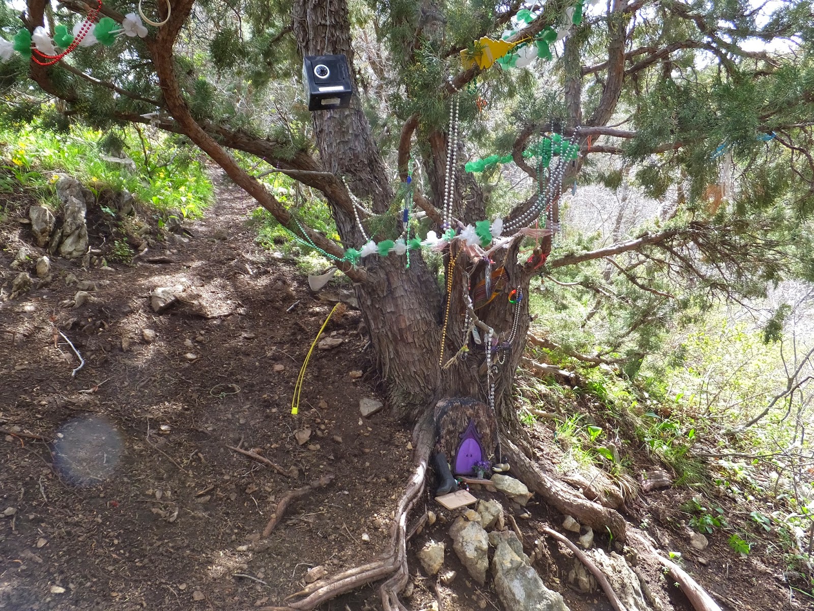
Speaking of fairy tales, a wrong turn on one of the switchbacks will bring you to this "fairy shrine".


After a brief stop at the overlook for pictures and a snack, my friend and I decided to explore a little further and continue following the trail towards upper Thayne Canyon.  We hiked for another half mile before the snow became more frequent and we decided we were finished for the afternoon.


This overturned tree root looked like some kind of scary animal from the before mentioned fairy tale.  We got spooked (because of the snow not the tree) and turned around at this point.  Plus my legs were getting tired.


♥ ♥ ♥ ♥ ♥ ♥ ♥ ♥ ♥ ♥ ♥ ♥ ♥ ♥ ♥ ♥ ♥


 Wildflower of the Week


This is a Glacier Lily, one of my all time favorite early spring wildflowers.  They are everywhere this time of year in the lower canyon areas.  Even though these lilies are found in abundance take the time to appreciate their delicate beauty.


For myself I hold no preferences among flowers
so long as they are wild, free, spontaneous!"
Ed Abbey

♥♥♥♥♥♥♥♥♥♥♥♥♥♥♥♥♥♥♥


******Miles hiked tally
beginning March 22, 2013
Beginning of this Blog


257.7

Monday, April 21, 2014

Mount Van Cott

Mount Van Cott is a small mountain (more of a knoll really) just east of the University of Utah which has the nickname of the "Butt Burner".   Mount Van Cott was named after Lucy May Van Cott who was the first dean of women at the University of Utah from 1907 to 1931.  I wonder if she was also a hiker?   There are many paths leading to the summit of Mount Van Cott.  I picked a trail heading north from Red Butte Canyon and just started climbing up.  For me, this Easter Sunday morning hike was just about immersing myself in nature to find a little peace.  And it worked by the way!  Here is some of what I saw along the way.
Don't know what these flowers are.

Magpie
Monarch Butterfly
Ladybug
Field of Springbeauties
University of Utah campus.
Kickin' down the mountain trail!
Sometimes when I'm hiking alone I create lyrics about hiking to popular songs (I'm weird, I know!), but here is a sample. . . . . . 

Slow down you move too fast, you want to make the hiking last.
Just kickin' down the mountain trail,
Looking at nature and feeling groovy!
Life, I love you!  All is groovy!!

Looking up at Mount Van Cott elevation 6348 feet.
The highlight of my hike was finding this handsome fella!  It is a horned lizard.  And he is really good at camouflage!
Horned Lizard
One of my favorite John Muir quotes was right on today "Nature's peace will flow into you as sunshine flows into trees".  I felt so much more peaceful at the end of hiking than I did at the beginning.

♥ ♥ ♥ ♥ ♥ ♥ ♥ ♥ ♥ ♥ ♥ ♥ ♥ ♥ ♥ ♥ ♥


 Wildflower of the Week


This wildflower is called a Tufted Evening Primrose.  It will open in the morning to become a beautiful, large, white flower but then closes and turns pink in the evening.  You will find the Tufted Evening Primrose on open sunny slopes during April, May and June.


For myself I hold no preferences among flowers
so long as they are wild, free, spontaneous!"
Ed Abbey

♥♥♥♥♥♥♥♥♥♥♥♥♥♥♥♥♥♥♥


******Miles hiked tally
beginning March 22, 2013
Beginning of this Blog


251.9

Wednesday, April 16, 2014

Mount Wire a.k.a Big Beacon

Spring is a great time to hike in the foothills above Salt Lake City.  Most of the snow is gone by this time of year on the low elevation peaks such as Mount Wire (elevation 7143 feet).  This is an excellent hike to begin conditioning for those higher peaks to climb in the summer.  Mount Wire has been described as a brown mound; but what this trail lacks in vegetation it more than makes up for in awesome views.  From the summit of Mt. Wire you look down into Emigration Canyon on one side and Red Butte Canyon on the other.  And the entire Salt Lake Valley to the point of the mountain is visible as well as Antelope Island and the Great Salt Lake.  I did mention that the views on this little mound were spectacular!
The trailhead is found above Research Park near the University of Utah.  Drive towards Red Butte Gardens and the new Museum of Natural History turning right on Colorow Drive and park alongside the road just before you reach the Huntsman Corp. building.  The trail begins on the left and will cross the Bonneville Shoreline trail before continuing to the right of Georges Hollow.  The popular "Living Room" hike is on the same trail.  You will reach a junction just shy of the one mile mark and the trail to Mt. Wire continues straight while the living room hike curves to the left.  The goal is to reach the old airway beacon which sets directly on the summit of Mount Wire.  There used to be two microwave radio reflectors also on the top of Mount Wire but they were removed last November.  The hike is 4.5 miles roundtrip with an elevation gain of 2140 feet.
Not quite there yet - false summit.


American Fork Twin Peaks in the far distance.
Old airway beacon - now we know we have almost made it!
Geodetic Marker

Adding a few feet of elevation
Mountain snail graveyard

First peak bagged of the year - Mount Wire!

♥ ♥ ♥ ♥ ♥ ♥ ♥ ♥ ♥ ♥ ♥ ♥ ♥ ♥ ♥ ♥ ♥


 Wildflower of the Week


This delicate little wildflower is a Wasatch Bluebell.  They are found scattered in the foothills this time of year and usher in the beginning of wildflower season.  Look close to the ground under the oaks or you may miss them.

"For myself I hold no preferences among flowers
so long as they are wild, free, spontaneous!"
Ed Abbey

♥♥♥♥♥♥♥♥♥♥♥♥♥♥♥♥♥♥♥


******Miles hiked tally
beginning March 22, 2013
Beginning of this Blog


248.8