Although Lambs Canyon is some what removed from the major canyons in our area, it has a very nice trail to hike and is really only minutes from Salt Lake City. Take I-80 East through Parleys Canyon and exit at Lambs Canyon #137. The trailhead is found about 1.6 miles from the freeway off ramp along a narrow, winding road. There is a restroom and a very small parking area (enough space for 4 or 5 cars) directly across the road from the trailhead.
  The trail climbs through fir, aspen and lush foliage following a small stream which hides from view in spots (heard but not seen) - very lovely. After about 2.2 miles you will reach the saddle which is the Millcreek Ridge or Lambs
Canyon Pass at 8,150 feet.
The elevation gain on this hike is 1560 feet, steep but not too steep. The trail from Lambs Canyon is the only Forest
Service hiking trail on the Parleys Canyon side of the ridge and they have recently done some trail maintenance which was nice to see.
The trail climbs through fir, aspen and lush foliage following a small stream which hides from view in spots (heard but not seen) - very lovely. After about 2.2 miles you will reach the saddle which is the Millcreek Ridge or Lambs
Canyon Pass at 8,150 feet.
The elevation gain on this hike is 1560 feet, steep but not too steep. The trail from Lambs Canyon is the only Forest
Service hiking trail on the Parleys Canyon side of the ridge and they have recently done some trail maintenance which was nice to see.  |
| Small stream - watch out for snakes. |
 |
| Sign at the pass. |
It was only an additional 1.4 miles roundtrip and an additional 710 feet of elevation to visit the radio tower, but I didn't love the trail. It felt a little like bushwhacking and our legs got pretty scratched. Okay, I'll admit it was interesting and the views were awesome. Best trail description however is told through pictures. Here are some of my best.
 |
| Nice view of Grandeur Peak on the right. |
 |
| Looking towards the Great Salt Lake and Antelope Island. |
 |
| First glimpse of the radio tower on the peak. |
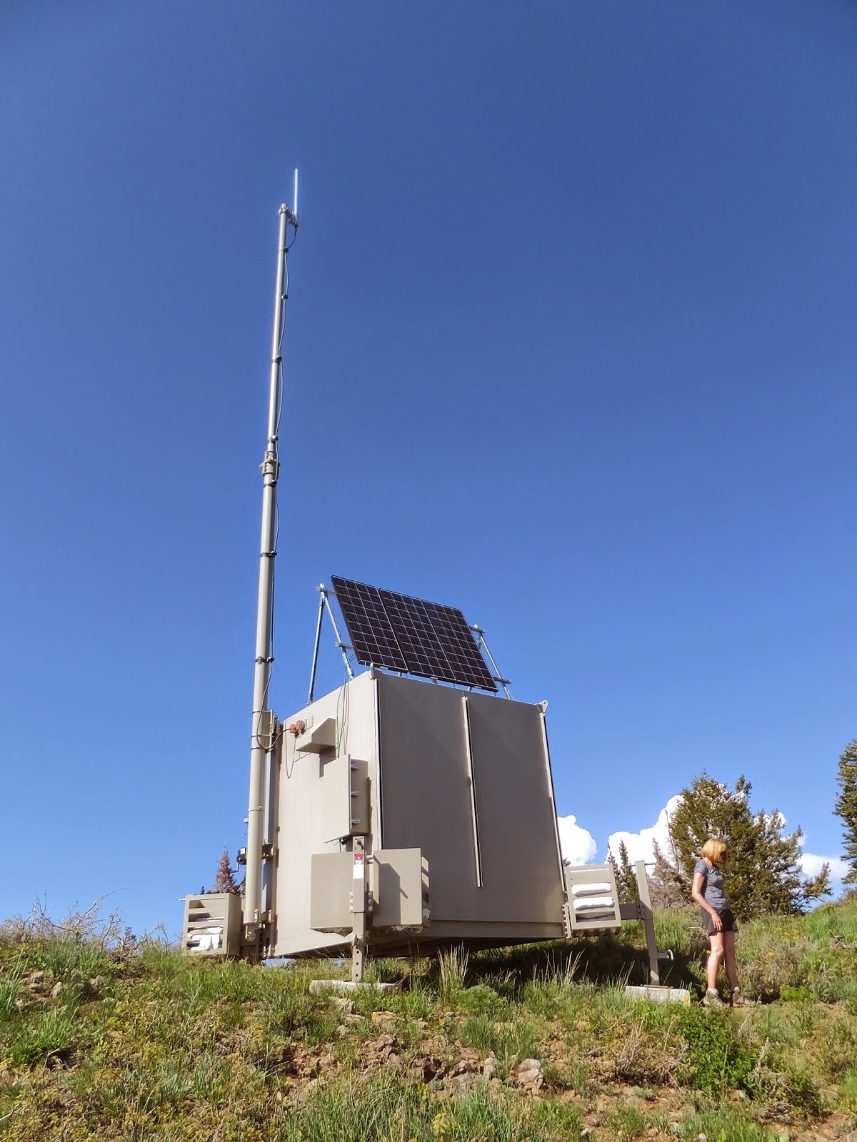 |
| Close up of the radio tower. |
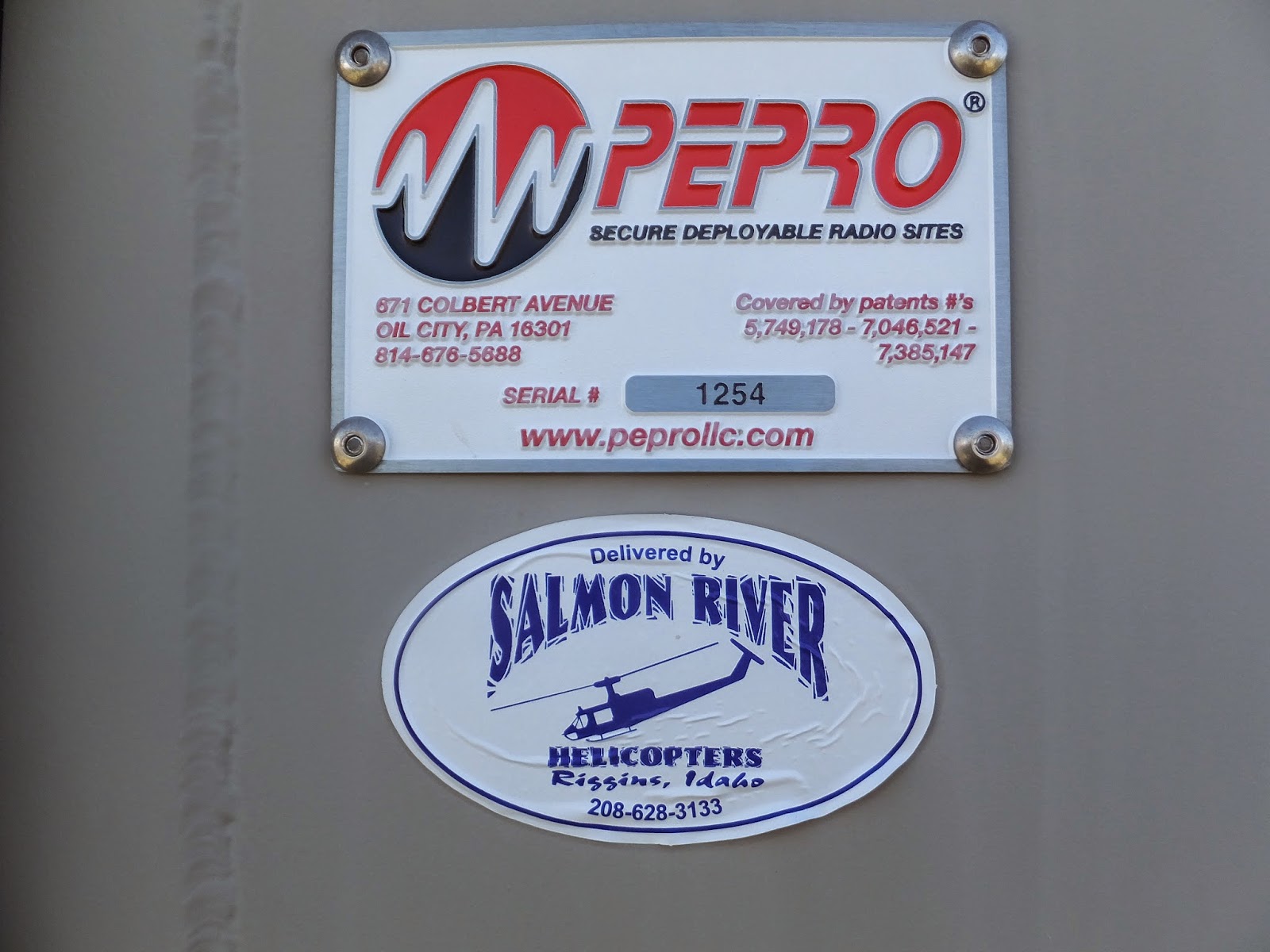 |
| Delivered by helicopter. |
 |
| From the radio tower peak looking at Gobblers Knob. |
 |
| Another mountain peak? |
 |
| Heading back down the trail from radio tower. |
 |
| The blue clematis were everywhere! |

♥ ♥ ♥ ♥ ♥ ♥ ♥ ♥ ♥ ♥ ♥ ♥ ♥ ♥ ♥ ♥ ♥
Wildflower of the Week

This mountain plant is called a Baneberry. Not sure it qualifies as a wildflower, but the white plumes were striking and so are the bright red berries the plant produces in the fall. Come to find out this plant is extremely toxic. All parts are poisonous! especially the roots and berries. The Baneberry bushes were thick on the Lambs Canyon trail.
For myself I hold no preferences among flowers
so long as they are wild, free, spontaneous!"
Ed Abbey
♥♥♥♥♥♥♥♥♥♥♥♥♥♥♥♥♥♥♥
******Miles hiked tally
beginning March 22, 2013
Beginning of this Blog
287.9
Beginning of this Blog
287.9