Sunday, July 27, 2014

Kanarra Creek Slot Canyon

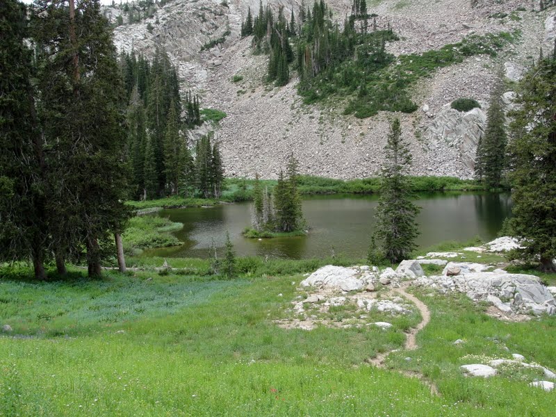
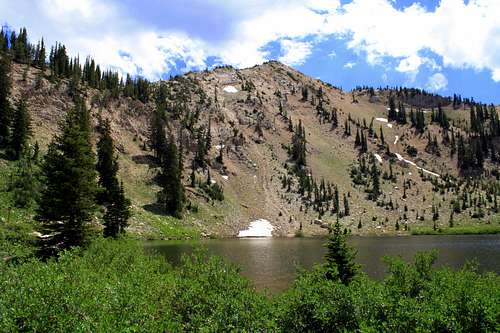
Kanarra Creek is a wonderful twisting, turning slot canyon located just east of the tiny community of Kanarraville, Utah. (population about 350 souls)   Yet another great Utah treasure!!  Kanarraville is located about 12 miles southeast of Cedar City.  Take exit 51 from I-15 and drive south on old highway 91 which becomes main street for Kanarraville.  Once you reach 100 North drive east a few blocks until you arrive at the designated parking area for the Kanarra Creek trail.  The parking fee is $10 per vehicle.  The first mile and a half of the trail follows an old access road into Hurricane Cliffs, past the water tanks.  This section of the trail is hot and very dry in the summer months so it is best to get an early morning start. When you reach the really fun part of the trail you will be wading in water for the rest of the hike.  Highly recommend water shoes and neoprene socks to help prevent blisters on the feet.  It is really quite remarkable that hikers are allowed through this slot canyon because Kanarra Creek is the water supply for the community.  Please be respectful of this beautiful resource.  I do fear that the popularity of this hike may limit hiker access if we are not careful.  The highlight of hiking Kanarra Creek is the two waterfalls you must climb to continue through the slot canyon.  The first rock jam waterfall has a nifty ladder to help you climb up. The second waterfall is a little more precarious and requires a lot more effort especially climbing down.  Many people especially those hiking with children will turn around at the second waterfall.  We hiked about a mile beyond the second waterfall and in my opinion the best of the slot canyon was before the second waterfall.  There was evidence of flood damage in the slot canyon, not the place to be during a thunder storm.  Here are my best pictures.  Loved this hike and will be back with the family!


A rip roaring flood hit the canyon at some point.
On the trail!
Along Main Street Kanarraville.
♥ ♥ ♥ ♥ ♥ ♥ ♥ ♥ ♥ ♥ ♥ ♥ ♥ ♥ ♥ ♥ ♥

 Wildflower of the Week

There were not a lot of wildflowers on the Kanarra Creek Trail, but I did find this pretty one that I haven't seen before.  It is Chicory.  Chicory is a highly nutritious forage plant and the roots when dried, ground up and roasted is used as a coffee substitute.  I loved the purple, blue color and look closely at the flower petals to see five distinct "teeth" at the end of each petal.


For myself I hold no preferences among flowers
so long as they are wild, free, spontaneous!"
Ed Abbey

♥♥♥♥♥♥♥♥♥♥♥♥♥♥♥♥♥♥♥


******Miles hiked tally
beginning March 22, 2013
Beginning of this Blog
317


Wednesday, July 23, 2014

Cedar Breaks NM Alpine Pond Trail

Need a road trip for the summer?  That includes a little hiking in the coolness of mountains above 10,000 feet?  That is very easy to drive to?   Cedar Breaks National Monument will definitely fit the bill for such a road trip.  Cedar Breaks became a national monument in 1933 thanks to FDR.  You have to love forward thinking presidents!  At over 10,000 feet above sea level this giant amphitheater covers about 3 miles and is more than 2000 feet deep!  And in July the wildflowers abound!  The entrance fee is $4 for adults and children 15 and under are FREE.  Cedar Breaks also hosts many activities for the entire family to enjoy from wildflower festival to star parties in summer to guided snowshoe walks in winter.   There are only a couple of hiking trails to choose from at Cedar Breaks NM and the only one I have tried is the Alpine Pond Trail.

Brian Head is the peak in the background.

The Alpine Pond nature trail is a two mile double-loop trail through forest and beautiful meadows filled with wildflowers.  I like hiking it as a figure 8 loop.  Half way through the loop hike is a natural, spring fed alpine pond. (Take bug repellant!) The park provides a nice trail guide to take along which points out interesting features of the trail - well worth the $1 donation.  It is sad to see so many dead trees surrounding the pond destroyed by a beetle infestation beginning in 1992.

There must have been something interesting at the pond.

One of my all time favorite wildflowers at Cedar Breaks is the lavender columbines.  The larkspur, lupines and mountain bluebells were some of the healthiest plants I have ever seen!

Tall Larkspur!

Very healthy Lupine
Lush Mountain Bluebell
Here is a list of many of the other wildflowers you will find in the park. http://www.nps.gov/cebr/planyourvisit/upload/Wildflowers.pdf

Don't forget to look for bristle cone pines on the trail.  They are some of the oldest trees in America.


My favorite way to Cedar Breaks NM is to exit I-15 at Parowan, Utah and travel on highway 143 to Brian Head Ski Resort then take highway 148 to Cedar Breaks.  It's a beautiful drive!  Drive on to Cedar City on highway 14 - more beautiful!  Add an evening at Cedar City's famed Shakespeare Festival and you have the makings of an awesome summer weekend road trip!


♥ ♥ ♥ ♥ ♥ ♥ ♥ ♥ ♥ ♥ ♥ ♥ ♥ ♥ ♥ ♥ ♥

 Wildflower of the Week

This beautiful magenta colored wildflower is called Parry's Primrose.  It typically blooms high in the mountains and loves to have wet roots so you will find it on waterfall ledges and streamsides.  You will find this gorgeous plant near the sink hole on the Alpine Pond trail at Cedar Breaks NM.  But don't touch the plant because just lightly touching will bring out a very unpleasant odor.


For myself I hold no preferences among flowers
so long as they are wild, free, spontaneous!"
Ed Abbey

♥♥♥♥♥♥♥♥♥♥♥♥♥♥♥♥♥♥♥


******Miles hiked tally
beginning March 22, 2013
Beginning of this Blog
310.8


Sunday, July 6, 2014

Bowman Fork Trail to Baker Spring

This weeks hike took me to Millcreek Canyon and the Bowman Fork Trail in the hopes of escaping the summer heat in the valley.  The plan today was to at least make it to Baker Springs and hopefully all the way to Baker Pass where trails continue on to Mount Raymond and Gobblers Knob.  Bowman Fork Trail begins at the Terrace Picnic area about 5 miles up Millcreek Canyon road.  Turn right at the sign for Terrace 1/4 mile, cross the bridge and make your way up the narrow road into the Terrace picnic area.  There is a small trail parking area located at the top of the picnic area.  The hiking trail for Bowman Fork is on your right with Elbow Fork trail on the left.   The first piece of the trail follows a lovely stream and is lush with plant life most notably thimble berry bushesThis section of trail is a favorite for dog walkers.  The trail then climbs steadily through a nice forested stretch which provides good shade until you reach White Fir Pass.

 May the forest be with you!!!


At White Fir Pass the trail faces a southwesterly direction, the conifers thin out and you have more exposure to the afternoon sun - too hot!  
Take a moment to appreciate the views of Porter Fork from White Fir Pass.
There were so many beautiful wildflowers along the way I just have to share a few.
Colorado Columbine


Scarlet Gilia

King's Yellow Flax


Paintbrush
 
Rocky Mountain Clematis

Next stop is Baker Springs 3.2 miles from the trailhead.  Baker Springs is the site of an old mining camp and you can still see evidence of mine tailings in the beautiful meadow.  Baker Spring also has a reliable water source (if you dare).
Now you can see Mount Raymond.
 And Gobblers Knob which isn't quite as impressive from this angle.

And also a view of Grandeur Peak and the Salt Lake Valley.

We only made it a little beyond Baker Spring before deciding to turn around for the day.  The hot afternoon sun had done us in.  I am a bit discouraged that I can't quite nail the big peaks. :(  I'm not getting any younger you know - but I'm still hiking. 


♥ ♥ ♥ ♥ ♥ ♥ ♥ ♥ ♥ ♥ ♥ ♥ ♥ ♥ ♥ ♥ ♥

 Wildflower of the Week

These blossoms are from a Thimble berry plant which later produce berries that look a bit like a raspberry.  The berries are edible, but I haven't tried one to report on the taste - yet.  The leaves on this shrub are huge, some up to 10 inches wide.  The first section of Bowman Fork trail following the stream was lined with many Thimble berry bushes.


For myself I hold no preferences among flowers
so long as they are wild, free, spontaneous!"
Ed Abbey

♥♥♥♥♥♥♥♥♥♥♥♥♥♥♥♥♥♥♥


******Miles hiked tally
beginning March 22, 2013
Beginning of this Blog
308.8

Friday, June 27, 2014

Brighton Lakes Updated

The Lake Mary/Catherine Pass trail gives hikers the opportunity to visit four lakes in just a 4.5 mile jaunt.  The trail begins at the base of Brighton Ski Resort in Big Cottonwood Canyon.  Lake Mary is a well known trail, but shhhhhhhhh here's a little secret - hike this one early in the morning to beat the crowds and have the best chance of seeing moose. 


The first small lake - more of a pond really - is Dog Lake just 500 feet from the main trail to Lake Mary.  Dog Lake is definitely worth a brief visit before moving on to the ever popular Lake Mary.


Next, on to Lake Mary! Another 1/4 mile past Dog Lake or 1 mile from the trailhead is Lake Mary.  Lake Mary is in a glacial basin and in 1916 a dam was built to create a water supply reservoir.  It is a watershed area and signs are posted at the lake - no swimming!  Lake Mary is an extremely popular hike so be prepared to share the trail all summer.  It is a beautiful large lake with Mount Millicent in the background and the entire area is even gorgeous buried under 6 feet of snow in winter.


Next comes Lake Martha.  Lake Martha is a much smaller lake that shares the same glacial basin with Lake Mary and is only .3 mile further on the trail.  Lake Martha sits at the base of Mount Tuscarora and has a unique island of small pines on the lake.  I love the solitude and peaceful setting of Lake Martha.  Lake Martha receives fewer visitors than her popular sister lakes - which is fine by me.  This last photo of Lake Martha was taken from high atop Mount Tuscarora in September of 2013 giving a nice bird's eye view of the lake.

The final lake and my all time favorite is Lake Catherine.  Lake Catherine is only another .7 mile from Lake Martha.  The trail climbs up to the ridgeline overlooking the upper bowl of Brighton Ski Resort then levels off as it makes it's way to Lake Catherine.  And by the way, this piece of the trail is part of the Great Western Trail system.  There are also some great views looking down upon Lake Martha and Lake Mary to check out before you drop down the trail and arrive at Lake Catherine.  Lake Catherine sits at the base of Sunset Peak and Pioneer Peak.

 Lake Catherine from a different angle looking toward Mount Tuscarora.


There was still a fair amount of snow on the trail as of June 22.  Use caution as the drop offs are very steep!


♥ ♥ ♥ ♥ ♥ ♥ ♥ ♥ ♥ ♥ ♥ ♥ ♥ ♥ ♥ ♥ ♥

 Wildflower of the Week


One of my favorite early summer flowers high in the mountain meadows are Marsh Marigolds.  The brilliant white blossoms and shiny green veined leaves are hard to miss.  These wildflowers often form dense colonies and sometimes push their way through melting snow.  Marsh Marigolds are from the Buttercup family.


For myself I hold no preferences among flowers
so long as they are wild, free, spontaneous!"
Ed Abbey

♥♥♥♥♥♥♥♥♥♥♥♥♥♥♥♥♥♥♥


******Miles hiked tally
beginning March 22, 2013
Beginning of this Blog
302.4